
BY Andreas Papp / ON 13 February, 2026
When people talk about farmer–herder conflict in Nigeria, it is often framed as an ethnic or cultural problem. That framing is convenient, but it is also misleading. What is unfolding across large parts of the country, particularly in the Middle Belt, is not driven by identity alone. It is driven by land, movement, survival, and a growing mismatch between how people have lived for generations and the realities they now face.
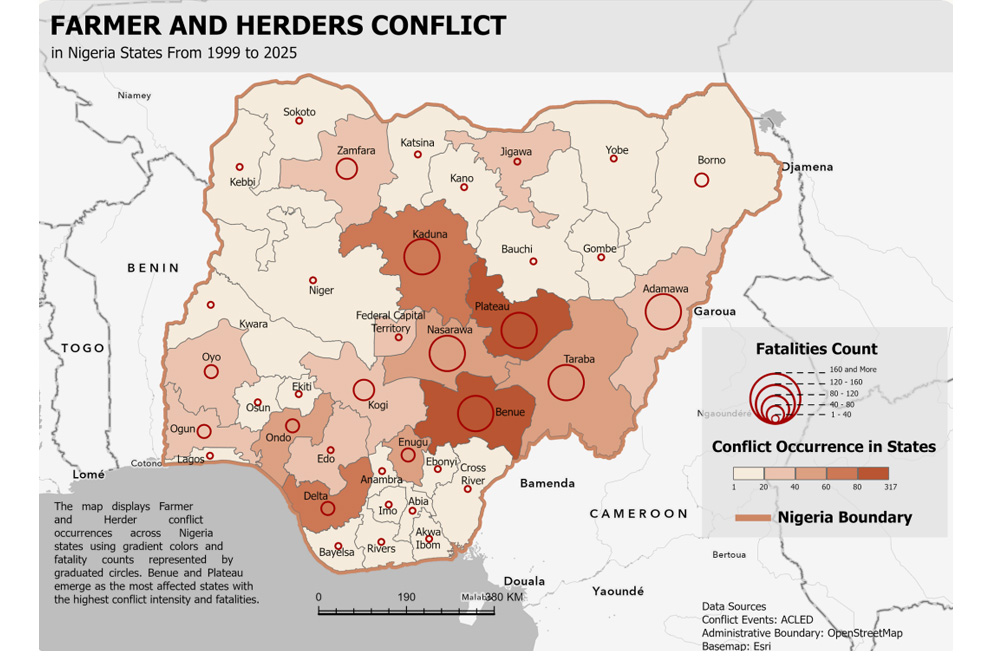
If you look closely at conflict data from the past two decades, a clear pattern appears. From 1999 through 2025, incidents linked to farmer–herder tensions have steadily increased, with sharp rises in recent years. Climate change has altered rainfall cycles and reduced the predictability of water and pasture. Expanding farmland and infrastructure have narrowed or erased traditional grazing corridors. Population growth has intensified competition for space. Environmental degradation has pushed both farmers and herders closer to the edge of what the land can sustain.
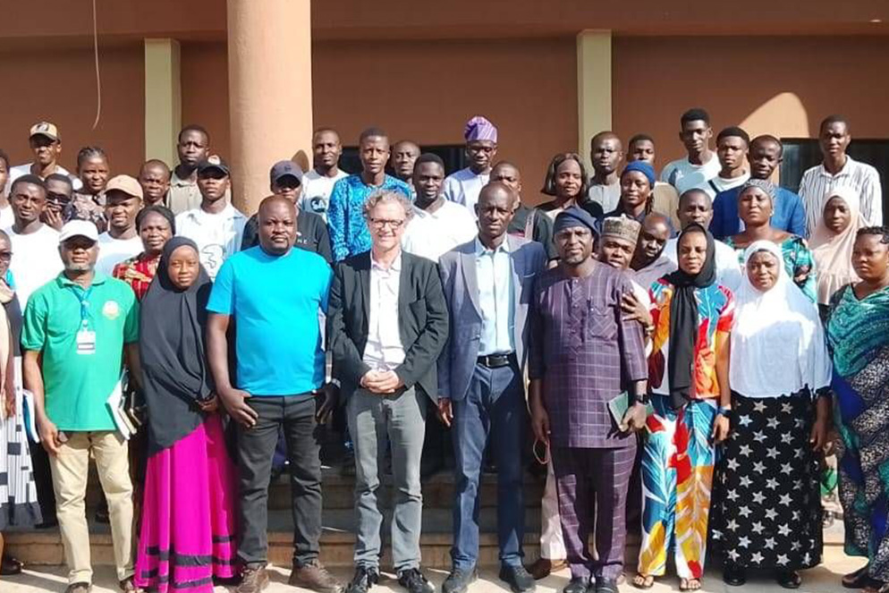
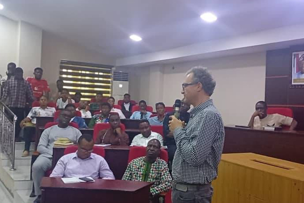
The conversation revealed a central tension in the PeaceTech field: Panic YES represents domination, exclusion, and loss of trust, while Panic NO symbolises creativity, co-creation, and community ownership. Both speakers emphasised that the future of PeaceTech cannot be designed by engineers alone. It must also be imagined by artists, researchers, and local communities who bring ethics, empathy, and cultural understanding into the process.
The Middle Belt states of Benue, Plateau, and Kaduna sit at the centre of this pressure. These areas are among Nigeria’s most important agricultural zones, where farming is not just an occupation but the backbone of local economies and food security. Benue, widely known as the country’s “food basket,” produces staples that feed millions far beyond its borders. At the same time, these states lie directly along major transhumance routes used by pastoralist herders moving seasonally from north to south in search of grazing and water.
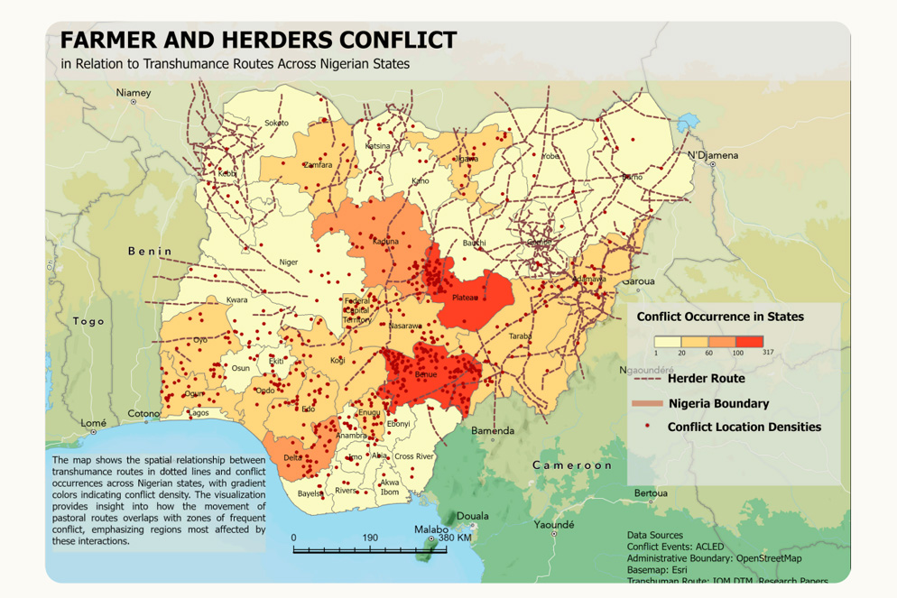
When conflict maps are overlaid with these routes, the overlap is striking. Areas with the highest concentration of incidents are often those where seasonal livestock movement intersects with densely farmed and populated land. In contrast, northern and northeastern regions where pastoral routes remain more continuous and less fragmented tend to show fewer conflict hotspots. This does not mean tensions are absent, but it does suggest that clarity of movement and access matters. Where routes are predictable and less obstructed, there is less friction. Where movement becomes improvised and contested, conflict escalates.
For farmers, the fear is losing crops that represent months of labour and the difference between feeding a family or going hungry. For herders, the fear is losing livestock that may be their only source of income, status, and security. When neither side knows where the other is going, what land is accessible, or whether an agreement exists, mistrust fills the gap. Small incidents quickly spiral, especially in areas where state presence is weak and informal justice prevails.
This is the context in which the Herders–Farmers App was conceived. Not as a silver bullet, and not as a replacement for dialogue, tradition, or policy reform, but as a practical tool that helps reduce uncertainty in everyday decisions. The logic behind it is deliberately simple. Many conflicts do not start with violence. They start with assumptions. A field that looks unused. A path that was once open. A herd passing through land where permission was never clearly given or denied.
The app addresses this by making land use visible and shared. Registered farmlands are digitised and geo-fenced, creating virtual boundaries that both farmers and herders can see. For farmers, this improves oversight and management of their land. For herders, it removes guesswork. An integrated alert system can notify users when people or animals enter or leave a geo-fenced area without authorisation, adding transparency in places where misunderstandings can quickly turn dangerous.
Crucially, the app also creates space for cooperation. Farmers can temporarily list grazing land that is available, set clear conditions, and approve access. Herders can search for and navigate to authorised grazing areas, reducing the need to take risks or rely on informal arrangements that may not be honoured. Grazing becomes an agreed activity, bounded by time, location, and consent.
Movement itself is treated with the same care. Suggested transhumance routes are based on traditional paths that have been used for generations, but digitally refined to avoid densely populated or high-risk areas wherever possible. These routes aim to reduce disruption to farming communities while supporting safer livestock migration. They acknowledge that pastoralism is not disappearing, but that it must adapt to a landscape that has changed dramatically.
What matters just as much as the technology is how it is developed and used. The Herders–Farmers App integrates local stakeholder participation, ensuring that its design reflects real needs rather than abstract assumptions. Peacebuilding, in this sense, is not imposed from above. It is embedded in daily practices, shaped by those who live with the consequences.
At PeaceEye, the broader mission is to provide timely, location-specific risk intelligence that helps people navigate volatile environments with greater confidence. The app is a direct expression of that approach. It turns conflict data and geographic insight into something tangible and actionable, accessible not only to decision-makers but to communities themselves.
The rise in farmer–herder conflict across Nigeria is a warning sign of deeper structural stress. Land is under pressure. Climate shocks are intensifying. Traditional systems of negotiation are struggling to keep pace with change. Digital tools will not resolve these forces on their own, but they can help slow escalation, rebuild trust, and create space for longer-term solutions to take root.
Peacebuilding does not always look dramatic. Sometimes it looks like fewer surprises, clearer agreements, and safer journeys. Sometimes it looks like a farmer knowing their land is respected, or a herder knowing where they can go without fear. To scale this work and extend its impact, PeaceEye is seeking impact-driven partners and investors committed to peaceful coexistence, economic resilience, and environmental sustainability. With the right support, technology can become a quiet ally in reducing conflict, turning contested spaces into shared ones, and helping communities move from reaction to prevention.